29 Best Asheville Hiking Trails – From Locals

From the Blue Ridge Parkway to the Pisgah National Forest, explore these breathtaking Asheville hiking trails ranging in length and difficulty – from locals.

It’s no secret that one of the reasons we moved to Asheville, North Carolina is because we fell in love with those blue and green smoky mountains.

Heck, the Blue Ridge Mountains are even in our logo, and you can bet that they host the best hiking near Asheville (AVL).

But, with so many trails, lakes, and state and national parks, how do you choose? Which hiking trails near Asheville are pet and family-friendly?

Where can you see blooms and chase waterfalls? What are the best picnic, fall foliage, and sunset spots?

Whether you are just visiting for fun or live in Western North Carolina (WNC), we are sharing the best hikes near Asheville – both short and long – with a variety of difficulty levels.

Learn what to expect and where to park; most importantly, see where the locals hike in Asheville.

Come trek the Blue Ridge Parkway, Pisgah National Forest, Gorges State Park, DuPont State Forest, Black Mountain range, the Smokies, and those coveted waterfall hikes.

We’ll also talk about the top hikes in Asheville proper, including parks, gardens, and nature trails – and even Biltmore Estate. Let’s get started!

*Please keep in mind that we aren’t giving professional hiking advice. These are just our experiences as a tipsy local travel writer and her pilot husband, hiking in Asheville.

Explore more of the best things to do in Asheville.

Asheville hiking trails with picture of blue and green mountains from Grandfather mountain in Western North Carolina
Discover the best Asheville hiking trails – from locals.

This post may contain affiliate links that earn us a commission at no extra cost to you. If you love these free guides, support Uncorked Asheville with a small tip.

29 Best Asheville Hiking Trails

Craggy Gardens

Craggy Gardens Picnic Asheville NC with white brunette male in black fleece and cargo shorts grilling burgers on charcoal grillPin
We love grilling at the Craggy Gardens Picnic Area.

Quick Stats: Blue Ridge Parkway hike; easy to moderate 2-mile out & back; rocks, packed dirt, tall grass; parking lots with facilities; picnic areas

For some of the best hiking near Asheville – only 20 miles away from Downtown and about 45 minutes by car – Craggy Gardens is a must with a variety of trails and picnicking options.

Craggy Gardens is especially gorgeous in the spring and summer with purple, white, and golden blooms. It’s also one of the most popular Asheville hikes.

We especially enjoy the Craggy Garden Picnic Area. Here, find an abundance of parking, charcoal grills, picnic tables, and restrooms along with trailhead access.

We’ve brought our own charcoal and grilled burgers many times – and it’s one of our favorite picnic areas near Asheville. Throw a frisbee and catch some sun.

The main trail is just a little under 2 miles round trip with a gazebo and beautiful fields. Of course, you’ll find flowers and heart-stopping mountain views.

The Craggy Gardens Visitor Center – where you can also start (or end) this hike – has stunning views of the fall foliage along with clean and seasonal restrooms, snacks, and a souvenir shop.

Please just keep in mind that the mountains are always colder than the city. Temperatures may drop 10-20 degrees cooler, and the mountain weather changes quickly.

Sun in Asheville doesn’t mean sun along the parkway. We always recommend wearing layers, especially for any of these Blue Ridge Parkway hiking trails near Asheville.

Also, always double-check with the NPS to ensure the BRP gates are open; they close for winter weather like ice and snow.

If you only have 36 hours to spend in Asheville, the BRP is a must!

Craggy Gardens Visitor Center (MP 364.4) | 364 Blue Ridge Pkwy, Black Mountain, NC 28711 or Craggy Gardens Picnic Area (MP 367.6) | 3676 Blue Ridge Pkwy, Barnardsville, NC 28709

DuPont State Forest

Quick Stats: Various level and length trails; for beginners, start with the 3-waterfall hike; gravel, rocks, and packed dirt; picnic areas, facilities at some parking lots

For the best waterfall hiking trails near Asheville, head to DuPont State Forest. This beautiful North Carolina state park is about 45 to 50 minutes from Asheville.

The park is free to enter, and there are endless trails throughout the area, perfect for hiking and mountain biking. Find a visitor center and multiple restroom facilities.

Two of the waterfalls – Bridal Veil Falls and Triple Falls – are The Hunger Games filming locations. Bridal Veil Falls was also in The Last of the Mohicans.

For the 3-waterfall hike – our favorite, clocking in around 3+ miles round trip – we suggest parking at the Hooker Falls Access Area.

Before crossing the scenic bridge, pick up the Hooker Falls Trail.

Follow the pathway for about .25 miles to the small falls, which is also one of the shortest and easiest hikes near Asheville, perfect for families.

Then, loop back up over to the bridge for a moderate .5-mile climb to see Triple Falls. High Falls is another .5 miles after Triple Falls.

You may also pick up this hike from the Visitor Center, starting with High Falls. You could also continue on to Bridal Veil Falls after the covered bridge.

If you add on or hike Bridal Veil Falls on its own, it’s about a 4.4-mile out and back, ending at the waterfall. (Please note this is not the Bridal Veil Falls at Highlands.)

For Asheville hiking trails, DuPont is also a great stop if you plan on day-tripping to nearby popular mountain cities like Hendersonville.

Hendersonville is full of wineries, museums, breweries, coffee shops, restaurants, and seasonal apple orchards.

DuPont State Recreational Forest Visitor Center | 89 Buck Forest Rd, Cedar Mountain, NC 28718 or GPS to and park at “Hooker Falls Access Area”

Black Balsam Knob Via Art Loeb Trail

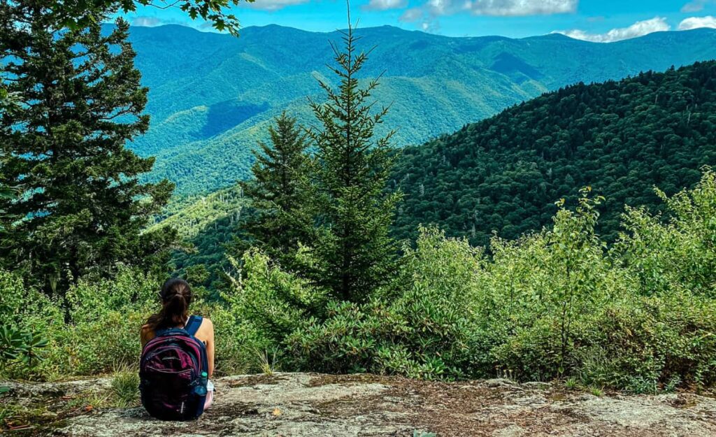
Black Balsam Via Sam Knob Trail BRP with white brunette female hiker with plum backpack standing on rock ledge overlooking mountainsPin
While hiking the Art Loeb Trail to Black Balsam Knob, dip over to Sam Knob.

Quick Stats: Moderate to easy, 2-mile Blue Ridge Parkway hike with runoff trails; rocks, packed dirt, incline/declines; pit toilets

It’s no secret that the best fall hikes near Asheville include Graveyard Fields and Black Balsam, both along the Blue Ridge Parkway.

Many people also choose Black Balsam or Craggy Pinnacle for engagement photographs.

Access Black Balsam via the Art Loeb Trailhead; here, there is also a parking lot with pit toilets.

The hike to Black Balsam Knob – with stellar views and plaque – is a fairly easy-to-moderate 2-mile trek with an incline, rocks, fields, and packed dirt.

To lengthen the hike, take numerous pathways that intersect with the Art Loeb Trail, including Sam Knob or Tennent Mountain.

You’ll find almost 360-degree views of the gorgeous mountains. Blueberries and vibrant wildflowers greet visitors in the summer.

The Art Loeb Trail itself is a total of 30 miles and another beautiful Asheville hiking trail.

Black Balsam is about 1 hour and 10 minutes by car from Asheville. We suggest getting there early, especially in the fall.

For top hiking in Asheville, Black Balsam is one of the trails we frequent the most after Craggy Gardens and DuPont State Recreational Forest.

Black Balsam | Black Balsam Knob, Art Loeb Trail, Canton, NC 28716

The NC Arboretum

The NC Arboretum Asheville Flowers with yellow and purple colors and red flowers in backgroundPin
Visit the gardens as well as hike amongst gorgeous wildflowers at The North Carolina Arboretum.

Quick Stats: Different length and difficulty level hiking trails perfect for families, including nature trails and gardens; pay to park; on-site facilities with a seasonal bistro.

For some of the best hikes in Asheville, head to the city’s gorgeous parks and gardens.

As annual members, we love The NC Arboretum for both peaceful Asheville hiking trails and garden events.

However, while most of the hiking trails on this list are free to access, you will have to be an annual member or pay for parking to enter the grounds. It’s worth it.

Located south of Downtown and immediately off of the BRP, enjoy botanical gardens and some of the easiest and most serene nature and hiking trails in Asheville – one of which also connects to the Bent Creek Experimental Forest.

The Arboretum’s 13 tails range in distance and difficulty. Find .3-mile to 1.3-mile trails.

Some allow for mountain biking. Most are either dirt or gravel too.

We especially love walking along the water on the Bent Creek Trail. In the winter, don’t miss the Arboretum’s Winter Lights, a holiday light festival in the gardens.

The NC Arboretum is about 20 minutes from Downtown AVL.

The North Carolina Arboretum | 100 Frederick Law Olmsted Way, Asheville, NC 28806

Moore Cove Falls

Moore Cove Falls in the Pisgah National Forest, NC near Daniel Ridge with waterfall cascading over a rock ledgePin
Moore Cove Falls is a gorgeous waterfall hike near Asheville.

Quick Stats: Pisgah National Forest waterfall hike; easy 1.4-mile out and back; no facilities

If you are looking for popular hiking near Asheville with waterfalls, Moore Cove Falls won’t disappoint.

About 50 minutes away in the Pisgah National Forest, Moore Cove Falls sits along the Forest Heritage Scenic Byway and is close to the famous drive-up waterfall, Looking Glass Falls.

Park in the designated lot along the road.

Then, trek a 1.4-mile out and back straight to a 50-foot waterfall. You might just catch a rainbow.

The trail is straightforward and consists of mostly packed dirt with some footbridges; the pathway can grow muddy.

You might have to walk over a few slippery tree roots, too, but it’s not excessive or too difficult.

Before or afterward, drive up to Looking Glass Falls, a 60-foot cascading waterfall known to freeze in the winter.

If it’s summer and you are traveling with the family, also visit nearby Sliding Rock – a rock you can slide down in your swimsuit.

Nearby, check out terrific Brevard breweries like Ecusta and Oskar Blues.

Moore Cove Falls Trail | US-276, Brevard, NC 28712

Craggy Pinnacle

Craggy Pinnacle Blue Ridge Parkway NC in the summer with green grass, view oof Craggy Gardens Visitor Center parking lot, BRP road, and mountains around Craggy Gardens with blue sky and cloudsPin
One of the best Blue Ridge Parkway hikes for 360-degree views, trek Craggy Pinnacle.

Quick Stats: Moderate Blue Ridge Parkway hike; 1.4-mile out and back; 360-degree views; steep incline/decline; rocks that are slippery when wet or icy

Craggy Pinnacle is one of the shortest but more moderate hikes near Asheville, NC.

Located along the Blue Ridge Parkway about 50 minutes away, this Asheville trail is most well-known for its breathtaking 360-degree views at the top.

Hikers look down upon the Asheville Watershed, Craggy Gardens, and Mount Mitchell. Catch a famous Craggy Pinnacle sunset too.

The Craggy Pinnacle hike is about 1.4 miles as an out and back. We always take small runoffs when it’s not foggy.

You’ll find at least three scenic viewing areas around the top.

Just keep in mind that fog loves Craggy Pinnacle just as much as we love AVL beer. Sometimes you’ll find yourself in the clouds – literally.

The trail also becomes icier into late October/early November, especially after heavy rain. The foliage dies around this time too. Wear sturdy shoes.

There is a parking lot but your closest facilities are the Craggy Gardens Visitor Center.

For spring hiking near Asheville, Craggy Pinnacle and Craggy Gardens are one of our top picks.

Craggy Pinnacle | Milepost 364.1; 3641 Blue Ridge Pkwy, Barnardsville, NC 28709

Bearwallow Mountain

Cow at Bearwallow Mountain NC with white brunette female and black cow behind herPin
While you might try to respect the cows’ space at Bearwallow Mountain, they might not respect yours.

Quick Stats: Easy and kid-friendly hike ending in a pasture with cows and views; 2-mile loop or out and back; no facilities

For more great family-friendly hiking trails near Asheville, Bearwallow Mountain promises great views and some side-eyeing cows.

Park alongside the road in dirt spaces, and head to one of two trailheads – a wide gravel one-mile path or a one-mile trail through the forest.

Because there are two trails, hike either one as an out and back or combine them for a 2-mile loop.

Bearwallow is another one of the best Asheville hiking trails for picnics, sunsets, and yoga.

Just watch for cow pies – and please leave the cows be (although they might not follow that advice, themselves).

Asheville to Bearwallow Mountain is about a 35+ minute drive.

Bearwallow Mountain | 4854 Bearwallow Mountain Rd, Hendersonville, NC 28792

Abandoned Plane Crash Site at Waterrock Knob

Crashed Passengers Aircraft Waterrock Knob NC with image of inside of crash Cessna plane with nothing but shell and debrisPin
A tough hike off of the Blue Ridge Parkway, Waterrock Knob connects to this tragic plane crash site.

Quick Stats: Moderate to difficult Blue Ridge Parkway hike to an abandoned plane crash site; 2+-mile out and back that can be confusing; slippery, rocky, and muddy; facilities and picnic area

If you are intrigued by ghost towns and abandoned places, we have one of the spookiest (and saddest) Asheville hikes for dark tourists.

Head toward Maggie Valley along the Blue Ridge Parkway about 50 minutes away from Asheville.

Here, park at the Waterrock Knob Visitor Center – with facilities – and start hiking along the Waterrock Knob trail until it intersects with the abandoned plane crash trail (yellow blazes).

From Waterrock Knob, the crash site lies about .6 miles+ further into the Great Smoky Mountains.

This is some of the trickiest hiking near Asheville as the trail faces erosion. Experienced hikers should expect to navigate hills, roots, and slippery rocks.

At the end of the trail, find the Cessna’s fuselage and scattered as well as sharp and dangerous plane parts.

Please just remember that Pilot Ernest Martin (53) and his secretary “Centa” Eggar Jarrett (42) died here, flying the Cessna 414 into the Jackson County Airport.

The trail is about a 2-mile out and back, and you’ll want solid navigation tools.

For more nearby Asheville hiking trails, head to Maggie Valley’s Soco Falls.

Waterrock Knob Visitor Center | Milepost 451.2; Waterrock Knob, Sylva, NC 28779

Laurel River Trail

Laurel River Trail Hot Springs, North Carolina with image of cascading stream of water through rocks and mossPin
The Laurel River Trail is one of the most local-popular hikes near Asheville.

Quick Stats: Easy and scenic 7+-mile out and back along Big Laurel Creek near Hot Springs, NC; muddy, gravel, rocks, roots, and flat; no facilities

Whether you live in AVL or are visiting for the weekend, there are plenty of things to do in and around the city, including day trips to the surrounding mountain towns.

Hot Springs, NC is one of our favorites for lesser-known hiking trails near Asheville – think Lover’s Leap and the Laurel River Trail.

Plus, find food, water sports, mineral water hot tubs, local beer, and quirky shops.

As one of the best hikes near Asheville for pets and families, the Laurel River Trail can be tailored to any length.

The first mile of the trail is wide, flat, and gravel – but it also sits on private land, meaning you cannot leave the designated pathway.

After the first mile – following along the scenic Big Laurel Creek, a popular area for whitewater rafting – the trail remains flat but narrows out with rocks, tree stumps, and mud.

A 7-mile round trip out and back, hike as far as you wish. The trail ends in the ghost mill town of Runion.

A 40-minute drive from Asheville, there is a large gravel parking lot that fills up with locals on weekends. For us, the Laurel River Trail is also one of the best Asheville hikes in the winter.

Read more about spending the winter in Asheville.

Laurel River Trail | Currently “Laurel Creek Trail” on GPS

Biltmore Estate

Biltmore Conservatory in back of Walled Gardens' blooms, pink and yellow tulips, in Asheville NCPin
We love hiking to the Biltmore Walled Garden from the Lagoon and Deerpark Trails.

Quick Stats: Various length and difficulty hiking and biking trails; requires a ticket, annual pass, or overnight property reservation to enter; on-site restaurants and facilities

Let’s talk about more hiking in Asheville – and one of our favorite spots, even as locals – Biltmore Estate.

As one of Asheville’s biggest attractions, it is easy to spend a day at Biltmore.

Tour the home, wine taste at Biltmore Winery, stroll the gardens, take a special tour, see the exhibits, and eat at one of Biltmore’s delicious restaurants.

Plus, Biltmore has over 22 miles of trails and gardens, which is part of the reason why we are annual passholders.

For top hikes in Asheville, find short and easy trails along with ones you can combine with others to make them more challenging.

We highly recommend the Lagoon Trail to start, following along the geese-filled water.

If you wish to sneak up on Biltmore House with access to the gardens – think Biltmore Blooms – and a breathtaking side view, continue onto the Deerpark Trail, which is 2.5 miles long.

Deerpark is also popular with low-key mountain bikers.

Biltmore’s trails are only 10 to 15 minutes from Downtown AVL. And, don’t forget that Biltmore’s Asheville trails and activities are family-friendly too.

Read more about the grounds with these interesting Biltmore facts.

Biltmore Estate | 1 Lodge St, Asheville, NC 28803

Mount Pisgah

Mount Pisgah Blue Ridge Parkway Hikes NC with dark gray clouds over green and blue mountains with red and orange leavesPin
One of the most popular fall hikes near Asheville, Mount Pisgah’s summit promises terrific views.

Quick Stats: Blue Ridge Parkway hike; 2.6-mile out and back with steep incline/decline and summit views; nearby picnic area

Mount Pisgah is by far one of the most recognizable mountain peaks around Asheville seen from the Grove Park Inn, Downtown AVL, and Biltmore Estate.

For popular Asheville hiking trails, Mount Pisgah gets slammed with fall travelers, especially with that 5,721-foot summit and famous observation platform.

A moderate uphill hike about 1 hour away from the city, we enjoy hiking Mount Pisgah for the less-crowded summer rhododendron and mountain laurels.

The Mount Pisgah Trail is a tad tiring with an elevation gain of 750 feet. Encounter grueling mountain stairs and some minor rock “stepping.”

Round trip, the trail is about 2.6 miles, and expect to navigate loose and slippery rocks. Please keep your eyes on the weather too.

We’ve definitely gotten caught in a rain shower at the top. Find parking at the bottom of the trail and across the street at the picnic area.

For more hikes near Asheville, we used to suggest nearby Skinny Dip Falls. However, flooding has damaged much of the trail and waterfall.

Mount Pisgah | Milepost 407.6 along the BRP; Mount Pisgah Trail, North Carolina 28716

Max Patch

Max Patch Appalachian Trail with dirt pathway and blue green mountains at summitPin
If you are looking for Appalachian Trail access, head to Max Patch.

Quick Stats: 1.5-mile or 2.5-mile loop along a mountain bald; currently, no camping; Appalachian trail access; packed dirt and long grass

For more popular hiking near Asheville, Max Patch is a must. Just go knowing that this Asheville hiking spot has been a bit of a sore spot with locals for the past few years.

The increased traffic and a few irresponsible hikers/campers have damaged this beautiful mountain bald, thus suspending all camping.

Hike one of two easy-to-moderate loops to encounter views of Mount Mitchell and the Smokies. Part of this hike also intersects with the famous Appalachian Trail.

Because you’ll find yourself on a bald without shelter, keep your eyes on the weather.

Asheville to Max Patch is about a 1-hour and 15-minute drive, and there’s a small dirt lot at the trailhead. The ride there can be tricky in wet or icy weather.

Max Patch | Max Patch Loop Trail Head; State Rte 1182, Del Rio, TN 37727

Trombatore Trail To Blue Ridge Pastures
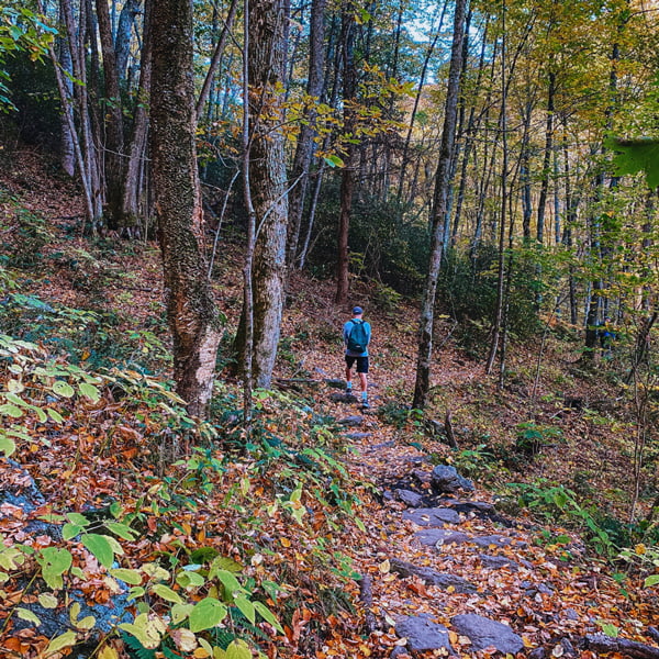
Conserving Carolina Trombatore Red Trail MarkerPin
Conserving Carolina maintains some of our favorite Asheville hiking trails.

Quick Stats: Moderate to difficult 5-mile out and back to a pasture across from Bearwallow Mountain

We are all about the quieter hiking trails near Asheville where we can picnic pretty much alone in a pasture.

If you are looking for a more strenuous and well-labeled hike, we highly recommend Trombatore Trail across from the Bearwallow Mountain Trail.

Trombatore follows along the Eastern Continental Divide with a 1,200-foot elevation gain and is managed by Conserving Carolina.

A more moderate to difficult 5-mile out and back, end at views of Mount Mitchell, Bearwallow Mountain, and the Hickory Nut Gorge.

Private property is clearly marked along this trail, as you will pass residential homes.

Asheville to Trombatore is about a 35-minute drive, and you’ll park along the designated road spots that are shared with Bearwallow.

To us, Conserving Carolina always has the best-maintained hikes near Asheville.

Trombatore Trail To Blue Ridge Pastures | Address: 4854 Bearwallow Mountain Rd, Hendersonville, NC 28792 (Across from Bearwallow Mountain)
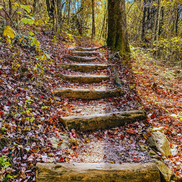
Graveyard Fields

Quick Stats: Blue Ridge Parkway hike; various trails and waterfalls; pit toilets; grows extremely busy in the fall

Located off of the BRP past the Mount Pisgah area, Graveyard Fields is about one hour from Asheville.

For popular hiking near Asheville, the trails boast two gorgeous and rocky waterfalls: Upper and Lower (Second) Falls.

Lower Falls is about .4 miles from the trailhead when you take a right after the footbridge. Around the footbridge, you may wade into the water.

Loop back to pick up Graveyard Loop Trail, which is about 2.9 more miles, round trip. Follow signs for Graveyard Loop/Upper Falls (right and then a quick left at the big intersection).

If you keep going right and accidentally pass Upper Falls Trail, you’ll land on the Graveyard Ridge Trail.

Graveyard Fields is one of the first Asheville hiking trails to see peak fall foliage, and when that happens, we suggest getting there very early.

Read our fall foliage forecast before going, and discover all that there is to do in Asheville around October.

Graveyard Fields & Graveyard Loop Trail | Milepost 418.8 on the Blue Ridge Parkway

Botanical Gardens At Asheville

white and yellow flowers at Botanical Gardens at AshevillePin
Catch the wildflowers at the Botanical Gardens At Asheville.

Quick Stats: Casual nature trails in Asheville; wildflowers and birds; visitor center, facilities

For casual hiking in Asheville, enjoy 10 acres of non-profit botanical gardens 10 minutes away from Downtown at the UNC – Asheville campus.

The Asheville Botanical Gardens are free to the public, and we sneak here to see gorgeous and rare wildflowers and birds.

The grounds are quiet, and visitors will find a literary cabin in the woods, beautiful bridges, labeled flora and fauna, nature trails, and large streams.

It’s also a great local picnic spot.

One of the shortest hikes in Asheville, the loop is around .5 to .7 miles. The Botanical Gardens at Asheville are not for you if you want a hardcore hike, though.

Park in the lot out front, and find a visitor center with information, restrooms, and a gift shop.

While here, explore more of the North Asheville neighborhood, and grab lunch along Merrimon or Charlotte at Taco Temple., Rye Knot, or Cecilia’s Kitchen.

Nearby, Beaver Lake is another great place to stroll in Asheville with a 2.2-mile perimeter trail. The attached sanctuary is spectacular for birdwatching.

Or, get your literary travel on with a stroll through Historic Montford’s Riverside Cemetery. Thomas Wolfe and O. Henry are buried here.

Explore more of Asheville’s top neighborhoods filled with parks, food, lakes, and more.

Botanical Gardens At Asheville | 151 W T. Weaver Boulevard, Asheville, NC 28804

Mingo Falls

Mingo Falls Trail Cherokee NC with cascading waterfall, rocks, and green treesPin
If you love stairs, we have just the hike for you…

Quick Stats: Great Smoky Mountain waterfall hike; short .5 mile out and back with many stairs

If you are heading to Great Smoky Mountains National Park in Cherokee, NC, we have just the waterfall stop for you.

Just know that this Asheville hiking trail boasts the most steps; there are 161 of them. It’s pretty much nature’s Stairmaster.

Here, you’ll find one of the tallest waterfalls in the Southern Appalachians, Mingo Falls.

A gorgeous 120-foot waterfall, this is also one of the shortest hikes near Asheville at under .25 miles each way.

After climbing the stairs, expect a narrow dirt trail with roots leading visitors to a viewing bridge.

Mingo Falls to Asheville is about a one-hour and 20-minute drive and has a small dirt lot at the base of the trailhead.

Nearby, we suggest stopping at the Oconaluftee Visitor Center and River Trail, which boasts facilities, a souvenir shop, and a visitor center filled with information (and friendly park rangers) about the Smokies.

Behind the visitor center, stroll the Oconaluftee River Trail Trailhead along with access to the free Mingus Mill and Mountain Farm Museum.

For nature hiking near Asheville, you might just see wildflowers and elk while learning about how families lived in Appalachia long ago. The Oconaluftee River Trail is 3 miles, round trip.

Look for the barn, log farmhouse, and apple house.

Mingo Falls | Mingo Falls Eastern Cherokee Reservation, Cherokee, NC 28719

Pink Beds Loop

Pink Beds Loop Bridge with white brunette male sitting on the bridge over running stream. He is wearing shorts and a black fleece with a hat and sunglassesPin
Pink Beds Loop is good for the soul.

Quick Stats: Pisgah Forest hike and easy 5.5-mile loop perfect in spring and summer; packed dirt, bridges, boardwalks, and picnic area

Located in the Pisgah Forest close to the Blue Ridge Parkway, nature lovers will covet this 5.5-mile hiking trail near Asheville.

Pink Beds Loop promises streams with bridges, mostly flat ground, and even a boardwalk.

Best in the late spring and summer, spy butterflies, birds, and wildflowers. Plus, hike in a mountain bog.

This is a more local and less-trafficked Asheville trail with a sizable dirt parking lot. Asheville to Pink Beds Loop is about a one-hour drive.

Pink Beds Loop | Pink Beds Picnic Area, Pisgah Forest, NC 28801

Linville Falls

Linville Falls, which is a waterfall viewed  from above in a gorgePin
Get ready to visit the most photographed waterfalls in WNC.

Quick Stats: Numerous trails and waterfall access areas; facilities and visitor center

Much of the best waterfall hiking near Asheville is over an hour to two hours away, including Linville Falls.

Linville Falls is also one of the most photographed waterfalls in WNC and has a visitor center with restrooms.

The falls are about 90 feet high, and there are 5 viewpoints that total a 4-mile hike. There are different hikes that you can take, including Erwins View Trail and Linville Gorge.

To the left of the visitor center, don’t miss the lesser-known trailheads that take you around the falls and to the base.

For a challenging trail, Linville Gorge Trail is a 1.25-mile hike to the base of the falls.

We enjoy the Plunge Basin Overlook with a stunning waterfall view that is only about .5 miles round trip.

If you walk past the Visitor Center and cross the bridge, encounter a variety of trailheads ranging in difficulty with more waterfall views.

Upper Falls is about .5 miles round trip. Continue on to Erwins View Trail, which is 1.6 miles round trip from the Visitor Center.

For popular Asheville hiking trails, Linville Falls is worth the drive.

Linville Falls | BRP Mile Marker 316.4; Linville Falls Visitor Center

Bent Creek Experimental Forest

Explorer Trail Bent Creek Experimental Forest Asheville NC with white brunette female on mint colored mountain bike on dirt trail surrounded by fall foliage treesPin
Along with hiking, we enjoy mountain biking around Bent Creek Experimental Forest.

Quick Stats: Numerous trails with varying lengths and difficulty levels

Home to the Hard Times Trail and Lake Powhatan, Bent Creek Experimental Forest is one of the top AVL places to mountain bike.

It also houses some of the best hiking in Asheville with endless trails ranging in length and difficulty.

We’ve also witnessed families teaching their younger children how to mountain bike here. The trails offer a great introduction to outdoor adventures.

AVL locals flock to Bent Creek on the weekends – us, included.

Bent Creek Experimental Forest sits next to The NC Arboretum in South Asheville.

Find free parking lots around the Hard Times Trail and plenty of nearby off-street parking, depending on which trail you pick.

Discover even more of Asheville’s top recreational lakes.

Bent Creek Experimental Forest | Hard Times Trailhead at 375 Wesley Branch Rd, Asheville, NC 28806

Fryingpan Mountain Tower

Fryingpan lookout tower with person climbing endless level stairs with blue sky and clouds in backgroundPin
How do you feel about heights?

Quick Stats: Blue Ridge Parkway hike; easy and gravel 1.6-mile pathway to a fire tower; no facilities

We can think of plenty of hikes near Asheville that aren’t for those with a healthy fear of heights, including Fryingpan Mountain Lookout Tower.

Located just over one hour from Asheville along the Blue Ridge Parkway near Mount Pisgah, park outside the gates (and don’t block them) to access a moderate-to-easy 1.6-mile pathway leading to a fire tower.

Mostly gravel with a steady incline, the trail ends at a 70-foot lookout tower.

Here, enjoy 360-degree views of Mount Pisgah, the Blue Ridge Parkway, and Looking Glass Rock.

It’s not the most “woodsy” of Asheville hikes, but the views and scare factor are worth it.

Fryingpan Mountain Lookout Tower & Trail | Fryingpan Mountain Lookout Tower, Canton, NC 28716

Crabtree Falls

Crabtree Falls Blue Ridge Parkway Hikes NC cascading mountain waterfall surrounded by green treesPin
Who doesn’t love a breathtaking BRP waterfall?

Quick Stats: Blue Ridge Parkway waterfall hike; 2-mile out and back or 2.5-mile loop; dirt, mud, rocks

Waterfall hiking near Asheville doesn’t get any better than Crabtree Falls, which is about a 1-hour drive from Asheville.

Close to Little Switzerland, Crabtree Falls is a moderately easy – but slippery and sometimes muddy – 2-mile out and back to a 70-foot waterfall.

Or, take the slightly harder 2.5-mile loop once you arrive at the falls.

Although a fairly easy hike, some will find Crabtree Falls a bit more moderate as you navigate over the rocky, wet, and mucky terrain.

We’ve seen a few people struggle here versus other Asheville hiking trails. Those falls are breathtaking and worth it!

Crabtree Falls | Blue Ridge Parkway Mile Marker 339.5

Little Butt/Big Butt

Forest stairs at Little Butt Big Butt Trail with white brunette male in red shirt and green backpack walking up them surrounded by forestPin
With a marker coined “Point Misery,” you know you are in for a good time along the Little Butt and Big Butt Trail.

Quick Stats: Blue Ridge Parkway hike; 5.1-mile out and back; no facilities and limited parking

One of the more local hiking trails near Asheville along the Blue Ridge Parkway – 1 hour and 10 minutes by car – enjoy a largely quiet trek with stunning mountain views.

Little Butt and Big Butt may literally kick your butt, especially when you hit Point Misery. Pleasant sounding, right?

Honestly, anything with forest stairs is misery to us… However, we love Little Butt for a picnic on the rock and a good night’s sleep.

Little Butt Trail leads to Big Butt and starts at Walker Knob Overlook. The trail is about 5.1 miles total (we track every hike), although you’ll see it labeled as longer.

Little Butt is not marked once you arrive; look for a slightly hidden rock with incredible views of the Black Mountain range.

If you want to tack another mile onto your trip, head to Big Butt, which is an elevated climb without the Little Butt views.

There are also multiple Asheville hiking trails around here.

Before the trailhead, you’ll see markers for the Mountains-to-Sea Trail. Across the street, you’ll find a trail for Glassmine Falls.

Park in the small horseshoe lot.

Little Butt And Big Butt Trails | Walker Knob Overlook at 59700 Blue Ridge Pkwy, Black Mountain, NC 28711

Carl Sandburg Home

Quick Stats: Numerous trails at a National Historic Site; free to hike; located in Flat Rock, NC

NC is full of authors. Pulitzer Prize-winning writer and poet Carl Sandburg settled down in Flat Rock, NC, known as “Connemara” at the time.

At his 264-acre home, which is now a National Historic Site, find 5 miles of trails along with a farmyard, perfect for families.

One popular hike here includes the Glassy Mountain Trail, which is an easy-to-moderate trek.

Hike about 1 mile each way from the back of the Carl Sandburg Home into shaded woods.

Don’t miss the rocky overlook at the top.

For free hikes near Asheville – under 40 minutes away – these trails are easy to access and navigate.

If you park at the Hikers’ Lot, we clocked 3.5 miles walking distance to the house, Big Glassy Overlook, and back. House tours require tickets.

Nearby, explore Flat Rock, which promises food, coffee shops, and The Park at Flat Rock – perfect for strolls and picnics.

Carl Sandburg Home Hiking Trails | 1800 Little River Rd, Flat Rock, NC 28731

Hidden Falls, Rainbow Falls, & Turtleback Falls

Rainbow Falls NC with rainbow over waterfalls and dirt trailPin
Catch a rainbow at Rainbow Falls.

Quick Stats: Sapphire waterfalls hike; nearby visitor center with facilities; 4.1-mile out and back that is long but family-friendly; moderate to easy

Gorges State Park offers great hiking near Asheville, including Rainbow Falls. Asheville to the Gorges State Park Visitor Center is about a 1 hour and 15-minute drive.

We’d consider this a long but still fairly easy waterfall hike that lives up to its namesake. Spy an impressive 150-foot waterfall that may just have a rainbow in front of it.

Along the way, pass Hidden Falls, and if you go as far as Turtleback Falls, you’ll clock about a 4.1-mile out and back.

Be prepared to cross light streams. Much of the trail is packed dirt.

Know that people have died in this area. Always exert extreme caution around waterfalls.

Rainbow Falls sits in Gorges State Park and crosses into the Pisgah National Forest. Along with terrific Asheville hiking spots, people camp, picnic, horseback ride, and fish here.

Gorges State Park Visitor Center | 976 Grassy Ridge Rd, Sapphire, NC 28774

Craven Gap

Craven Gap Hiking Trail with white brunette woman in workout skirt and top looking out over Blue Ridge Mountains with hands on hipPin
Hike like the Obamas at Craven Gap.

Quick Stats: Local Blue Ridge Parkway hike; 5-mile out and back; not as scenic but quiet; no facilities

Hiking in Asheville is so spectacular, even former presidents have done it.

In 2010, the Obamas hiked at Craven Gap – located off of the Blue Ridge Parkway – specifically for its privacy.

We also enjoy the Craven Gap hike for its babbling brooks, mini-caves, and wooden bridge.

The trail collides with the Blue Ridge Parkway at the other end where you can pick up more trails.

For hikes in Asheville, Craven Gap may lack those coveted breathtaking views but the pathway is sure to pay you back in exclusivity and peacefulness.

Craven Gap is part of the Mountains-to-Sea Trail and is a little under 5 miles, in total. As a more moderate Asheville hiking trail, Craven Gap gets very narrow.

You may find yourself teetering on the edge of a rocky cliff. Park in a small dirt lot and look for the stairs.

This is a lesser-frequented, local trail 20 minutes from Downtown.

Along with hiking Craven Gap, the Obamas also dined at 12 Bones (RAD location) – one of the best BBQ joints in Asheville.

Craven Gap | Craven Gap Trail, N35.6479 W82.4910, Asheville, NC 28805

Daniel Ridge Loop & Falls

Daniel Ridge Falls Trail with woman in garnet colored winter coat with hood and purple hiking leggings sitting on a rock and looking at waterfallPin
Daniel Ridge Falls makes for a great winter hike near Asheville.

Quick Stats: Pisgah National Forest moderate 4-mile loop or an easy 1-mile out and back; no facilities; popular mountain biking area

It’s no secret that the Pisgah National Forest and areas around Brevard have some of the best hikes near Asheville.

It’s here where you’ll find Daniel Ridge, which has two options: a moderate 4-mile loop or an easy 1-mile out and back.

Both pass Daniel Ridge Falls, a 150-foot waterfall also known as Tom’s Spring Branch Falls.

The loop trail passes babbling brooks and streams. Hikers have to navigate rocks, roots, and puddles.

We highly recommend having strong navigation here. Cellular service is rough, and it can be easy to miss those red trail blazes, especially in the fall.

The shorter out and back is much easier and family-friendly.

Daniel Ridge provides the best biking and hiking trails near Asheville to skip the crowds. It’s about one hour by car and has a small dirt lot.

Daniel Ridge Loop & Falls | Daniel Ridge Falls, National Forest Rd, Brevard, NC 28712

Mount Mitchell

Mount Mitchell Blue Ridge Parkway NC with white brunette male and female standing in front of sign that says highest peak east of the Mississippi River elevation 6684 feet with stone viewing platform behind themPin
Visit the highest peak east of the Mississippi River at Mount Mitchel.

Quick Stats: Blue Ridge Parkway attraction with a variety of trails

Hiking in Asheville doesn’t get any more popular or “bucket-listy” than Mount Mitchell.

Famously, Mount Mitchell boasts the highest peak east of the Mississippi River at 6,684 feet – and trust us, you’ll feel it.

If you just want to experience the peak without the hiking, park in the designated paved lot and walk the gentle pathway up to the viewing platform, which labels mountain ranges.

Visitors may also choose from a variety of trail lengths and difficulty levels, including the Balsam Nature Trail, Deep Gap Trail, and Mount Mitchell Trail.

Asheville to Mount Mitchell is about 1 hour and 30 minutes by car.

Mount Mitchell State Park | 2388 NC-128, Burnsville, NC 28714

Chimney Rock State Park

Chimney Rock State Park with rock, view of Lake Lure, and American flag blowing in the breezePin
Chimney Rock is a large attraction for Asheville visitors.

Quick Stats: Popular attraction close to Lake Lure with a variety of trails; facilities and cafe; will grow busy during peak tourist seasons; must pay to enter

Along with Mount Mitchell, Chimney Rock State Park offers some of the most popular hiking near Asheville – and we suggest this one in the winter to avoid the crowds.

Around 45 to 50 minutes away from Asheville, pay to enter the park to see the 535 million-year-old monolith, which you can either hike to via the steep Outcroppings Trail or take an elevator.

For more strenuous hikes near Asheville, Exclamation Point Trail is moderate with quite a few viewpoints.

Or, try the moderate 1.4-mile round-trip waterfall hike to Hickory Nut Falls.

Afterward, grab ice cream and sandwiches in Chimney Rock Village or stroll Lake Lure, stopping by the Flowering Bridge. You might recognize Lake Lure from Dirty Dancing.

For more great Asheville hiking, try nearby Wildcat Rock in Gerton, which takes you past Little Bearwallow Falls.

Chimney Rock State Park | 431 Main St, Chimney Rock, NC 28720

Grandfather Mountain

Grandfather Mountain with views of the blue and green mountainsPin
Get the best views at Grandfather Mountain.

Quick Stats: Pay to enter this popular attraction; a variety of hikes, including one of the most difficult around; visitor center, facilities, and souvenir shop

Of course, we cannot forget Grandfather Mountain, which is 1.5 hours away and home to numerous Asheville hiking trails, Forrest Gump Curve, and the Mile-High “Swinging” Bridge, which you can hike to.

It’s here you’ll also find the hardest Asheville hike; Grandfather Trail is called the “chutes and ladders” trail for its assists – cables and ladders.

Permits are required to hike Grandfather Trail. You have to be back at your car by a specific time or they will send out a search team.

Grandfather Trail is one of the most difficult hikes near Asheville and is for experienced hikers only.

This blue-blazed trail is 2.4 miles long and crosses the summit ridge from the Mile High Swinging Bridge to Calloway Peak.

Personally, we are not cool enough to hike Grandfather Trail, but we have hiked other Grandfather Mountain trails; we wanted to let our experienced hikers and readers know it exists.

Grandfather Mountain | 2050 Blowing Rock Highway, Linville, NC 28646

Save This Hiking In Asheville Guide For Later:

Hiking Near Asheville NC Pinterest pin with photo of fall foliage blue mountains at Black Balsam via the Art Loeb Trail, an aerial view of the Blue Ridge Parkway two-lane highway from Craggy Pinnacle, and a cloudy mountain summit view from Mount PisgahPin
Did you find new Asheville hiking trails to try? Save this post for later, and hike like a local with Uncorked Asheville.

Where To Stay In Asheville

Explore the best places to stay in Asheville. A few of our top suggestions:

  • Aloft – Downtown Asheville – Centrally located and recently renovated, enjoy a rooftop pool, a gorgeous bar, and trendy rooms.
  • The Omni Grove Park Inn – Treat yourself to a luxury resort in North Asheville, complete with breathtaking sunsets, terrace bars and dining, and loads of Asheville history.
  • Hampton Inn And Suites Asheville Biltmore Area – A budget-friendly but renovated hotel on busier Brevard Road that’s perfect if you wish to stay between Biltmore Estate, Downtown Asheville, and the Blue Ridge Parkway.
  • Asheville Cottages – Gorgeous 1 to 3-bedroom cottages with a private deck, housing a grill and hot tub. Find luxurious heated-floor bathrooms with rain showers, a well-stocked kitchen, and the cleanest rooms in town.
  • Foundry Hotel – An oasis in Downtown Asheville, Foundry Hotel is a nod to AVL’s industrial history. Find famous restaurant Benne on Eagle while sleeping ensconced in charm and elegance.
  • Country Inn & Suites by Radisson, Asheville Westgate, NC – Located off of the highway as you enter AVL, find a sleek and clean hotel at a great price. 
  • Black Walnut B&B Inn – Designed by Biltmore’s supervising architect, Richard Sharp-Smith, this 1899 inn is close to Downtown AVL and serves afternoon tea. Two rooms are pet-friendly.

Don’t miss out on these Asheville properties on Booking.com, too.

What are your favorite hiking trails near Asheville?

If we had to name the best hikes in Asheville – as locals – we’d say DuPont State Forest, the Craggies, The NC Arboretum/Bent Creek Experimental Forest area, and Black Balsam.

Biltmore is convenient (with wine!), and Graveyard Fields lights up in the fall.

For more unique Asheville hiking trails, we enjoy the Laurel River Trail and Little Butt/Big Butt.

What are your top hikes near Asheville, and what’s on your bucket list?

Lastly, what is your favorite season for hiking in Asheville? Let us know in the comments!

You May Also Like:

Where To Roller Skate Near AVL

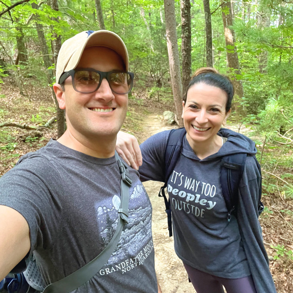
Christine and Tom selfiePin

Christine Frascarelli

Christine (pronouns: she/her) is the owner and lead writer of Uncorked Asheville. After falling in love with those gorgeous Blue Ridge Mountains, Christine and her husband Tom decided to call Asheville, North Carolina home. When her pointy Italian nose isn’t stuck in a book, Christine is adopting all of the kitties, getting lost in the forest, and drinking an ESB. She has a BA in English and History from Smith College, her MLIS from USF-Tampa, and is a former U.S. Fulbright Scholar - Indonesia. Christine also owns The Uncorked Librarian LLC with books and movies to inspire travel.

4 Comments

  1. As a new subscriber, I just want to say that your articles are very interesting and informative. Thank you so much for sharing so much information. 😊

  2. There are so many great sounding hiking trails around Ashville. It kind of reminds me of where I live as there are so many trails and hiking spots to check out. Even though I’m not really into hiking, much to my husbands dismay, I think it would be fantastic to visit some of these trails just for the scenery alone. I like how there are different lengths and difficulties so those who aren’t big on hiking can still get out and enjoy the trails without beating themselves up along the way.

    1. I cannot believe how many hiking trails there are around Asheville. This isn’t even half of them. Some of the Asheville trails are more like casual nature walks if hiking isn’t your thing. Those walks are always chiller and more pleasant, especially at places like Biltmore, The NC Arboretum, and the Botanical Gardens at Asheville.

Leave a Reply

Your email address will not be published. Required fields are marked *